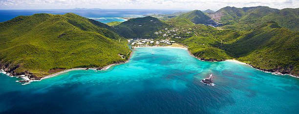
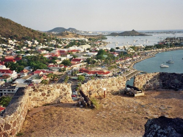
Saint-Martin
History of Saint Martin, French West Indies
It is commonly believed that Christopher Columbus named the island in honour of Saint Martin of Tours when he encountered it on his second voyage of discovery. However, he actually applied the name to the island now called Nevis when he anchored offshore on November 11, 1493, the feast day of Saint Martin. The confusion of numerous poorly charted small islands in the Leeward Islands meant that this name was accidentally transferred to the island now known as Saint-Martin/Sint Maarten.
At Columbus' time, St. Martin was populated, if at all, by Carib Amerindians. The former Arawaks had been chased by the Caribs coming from the north coast of South America a short time before the arrival of the Spaniards who followed in Columbus' wake. The Arawaks were agricultural people who fashioned pottery and whose social organization was headed by hereditary chieftains who derived their power from personal deities called zemis. The Caribs' territory was not completely conquered until the mid-17th century when most of them perished in the struggle between the French, English (later British), Dutch, Danes and Spanish for control of the West Indies islands around the Caribbean Sea.
The Dutch first began to use the island's ponds for salt in the 1620s.Then still at war with the Dutch, the Spaniards captured St. Martin in 1633. One year later, they built a fort (now Fort Amsterdam, near Philipsburg) and another artillery battery at Pointe Blanche to assert their claim and control access to Great Bay salt pond. A massive influx of African slaves took place in the 18th century with the development of sugarcane plantations by the French and Dutch. Slavery was abolished in the first half of the 19th century. On some of their territories the British imported Chinese and South Asians to take the place of slaves. Thus, St. Martin and the other islands are populated by a mixture of Amerindian, European, African, Indian, and Asian peoples.
Crossing from St. Martin to Sint Maarten, dedicated in 2008
Enlargeable, detailed map of Saint Martin
On 23 March 1648, the Kingdom of France and the Dutch Republic agreed to divide the island between their two territories, with the signing of the Treaty of Concordia. Folklore surrounds the history of the once ever-changing border division between St. Martin and Sint Maarten, and a popular story among locals narrates that "to divide the island into two sections, [in 1648] the inhabitants were told to choose two walkers, one chosen by the French-dominated community and the other one by the Dutch-dominated community, who were put back to back in one extreme of the island, making them walk in opposite directions while stuck to the littoral line, and not allowing them to run. The point where they eventually met was set as the other extreme of the island, and the subsequently created line was chosen as the frontier, dividing Saint-Martin from Sint Maarten. Seemingly, the French walker had walked more than his Dutch counterpart (they earned their respective lands 54 km² and 32 km²). The French locals' explanation for this discrepancy is that, as the first man chose wine as his stimulant prior to the race, while the latter chose Jenever (Dutch Gin), the difference between such beverages' lightness was said to be the cause of the territorial differences.